I think Hooker Valley is the best track in New Zealand in terms of the effort you have to put in and the beauty you get back. The whole thing is a fairly easy walk, five kilometres one way, and the entire route gives you epic views of the highest mountains in the country in every direction.
I have walked this track about four times now, and every time it has struck me with how beautiful it is. It suits people of any fitness level and any age, children included, and anyone at all who is able to cover ten kilometres.
Who the valley is named after
Most of the names around here were given by Julius von Haast, a New Zealand geologist of German origin who explored this area in the 1860s. He named the valley, the river and the glacier after the British botanist Hooker. The same logic produced Mount Sefton, Mueller and dozens of other names in the area: Haast named them after scientists and people he knew. One more detail: it was through this valley that the first successful expedition up Mount Cook went in 1894.
Unfortunately, the popularity of the track is also where its main problem lies. There are a lot of people here in pretty much any season, and in summer, over the Christmas and New Year holidays, there are even more.
So, depending on the forecast, it is better to arrive either no later than nine in the morning, or after lunch, around four or five, when it is still light but most of the crowd has gone. Even then you should be prepared for a lot of people. There are toilets at the car park, and another set roughly halfway along the track.
The elevation gain over the whole route is gentle and almost unnoticeable. Where to go is obvious straight away: there are plenty of signs, plus you can orient yourself by where everyone else is heading.
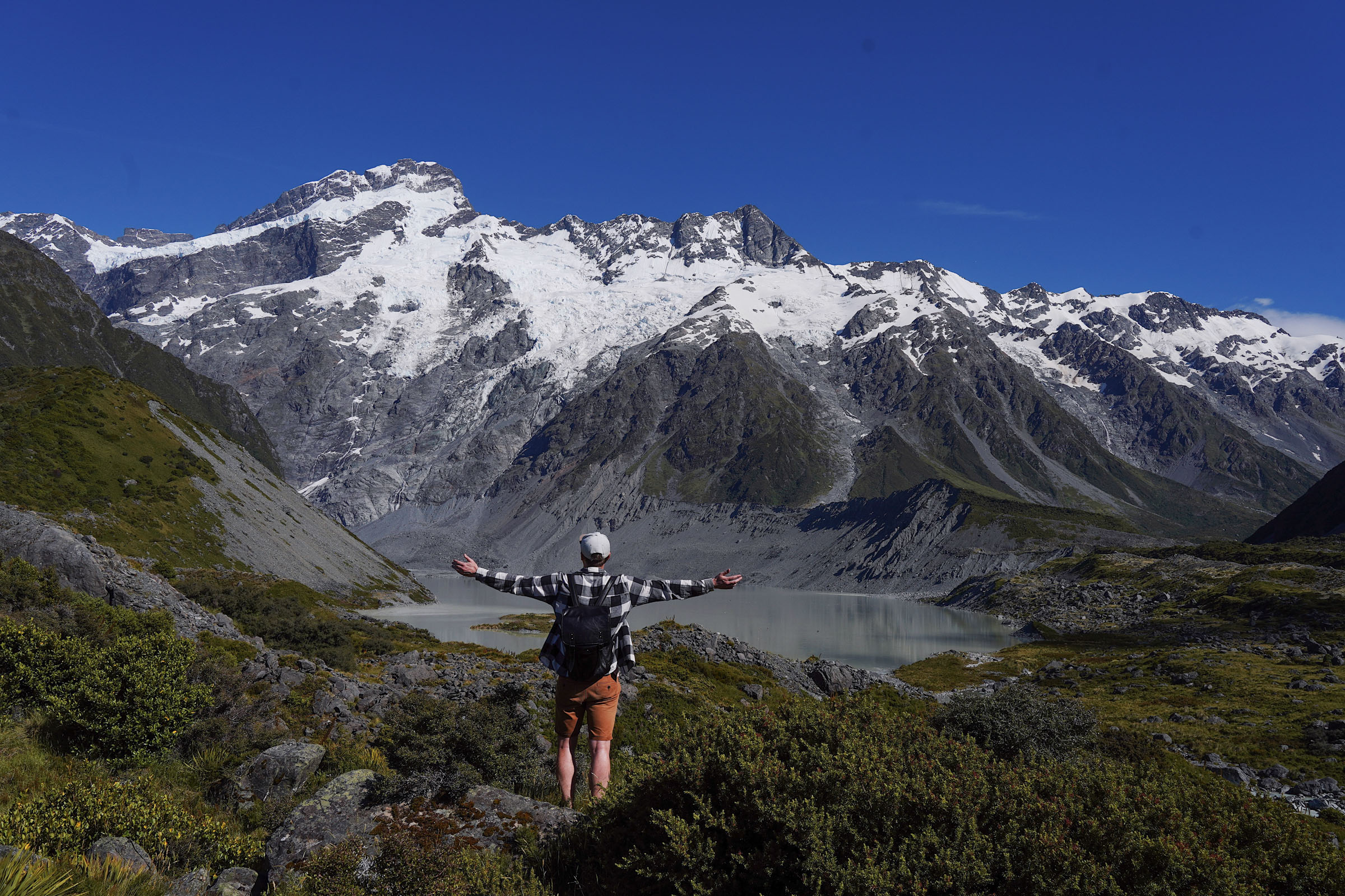
A kilometre in there is the first viewpoint over Mount Sefton and Mueller Lake. It is not very big, but you can move a little to the left, away from the crowd, to take a few photos. From the same spot you can see the first of the three swing bridges you will cross on this track.
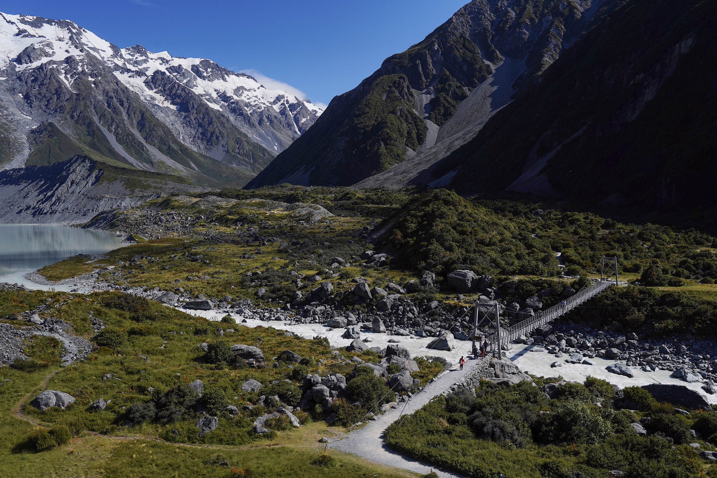
The bridge says the maximum load is 25 people, but at peak times there are always more than that on it, as you can see in the photo below. Nobody regulates the traffic there, and the bridge holds a much heavier load.
The bridge runs straight over the Hooker River, which further down flows into Lake Pukaki.
It is about another kilometre and a half to the next bridge, and on this stretch there are even more views. On the left you will see Mount Sefton and the Sefton Glacier, where small avalanches come down regularly: if you are lucky you will catch one or two as you walk. There will be plenty of spots to stop and take pictures.
The second bridge you have to cross is brand new, it was replaced in late August 2026. The track was closed for about a year and a half, so the current hype around this route is possibly down to exactly that. The last time I walked Hooker Valley was in September 2026, outside the tourist season and the summer holidays, and there were still a huge number of people.
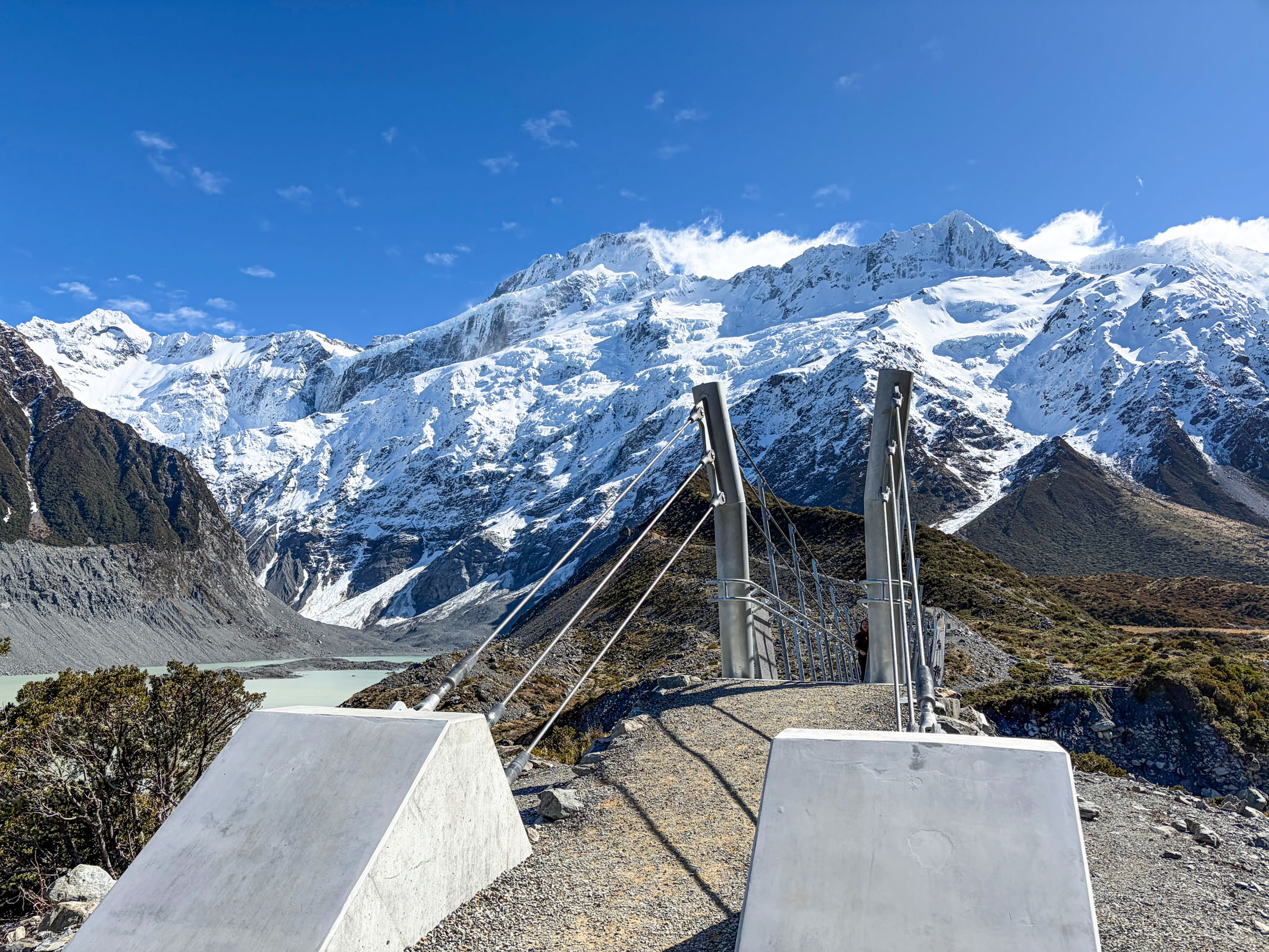
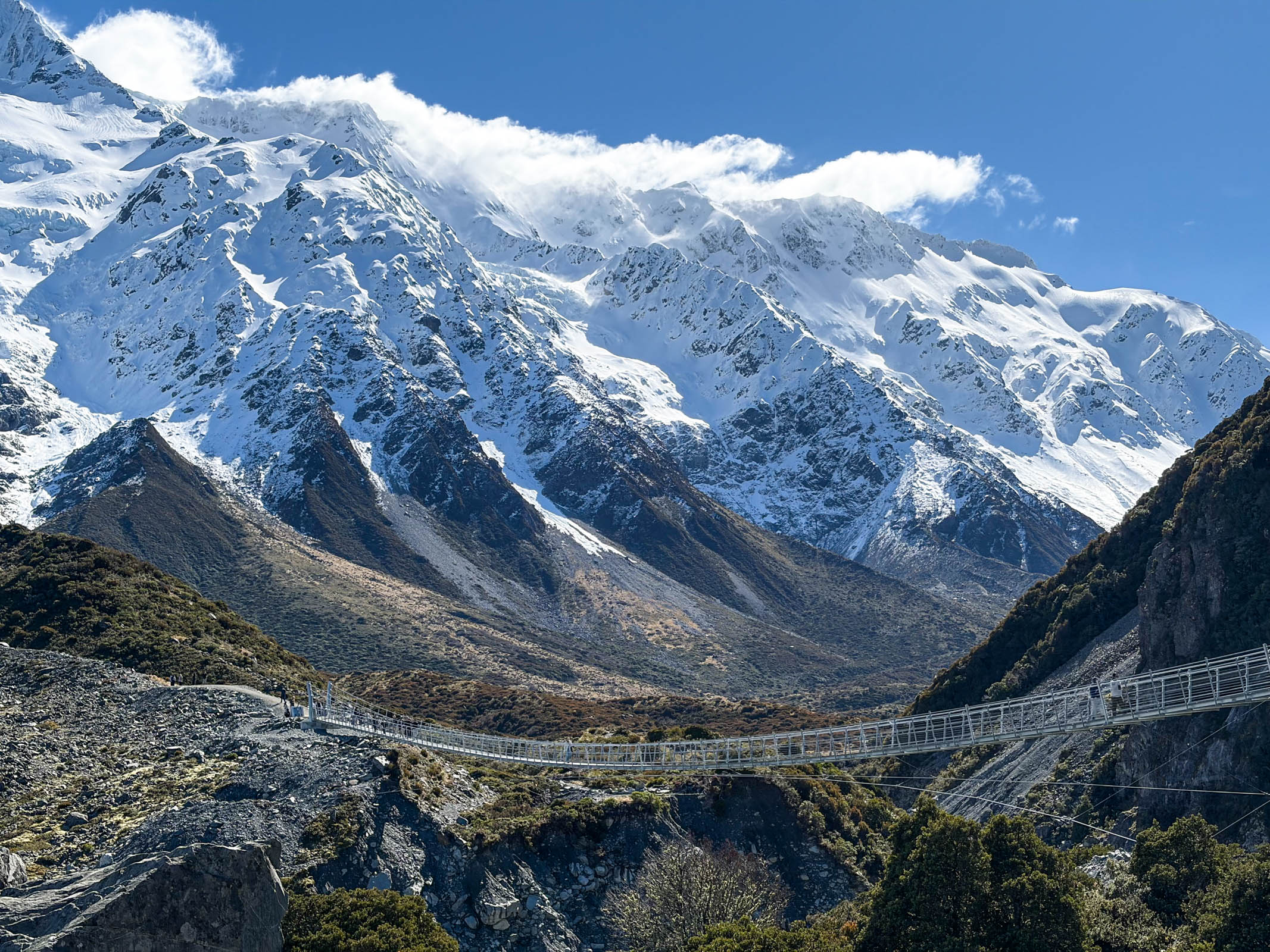
The new bridge
The span is 189 metres, which makes it the longest pedestrian suspension bridge in New Zealand. The old one was closed in April 2025, when a storm undercut the bank by its supports, and repairing it was no longer an option. The new bridge was built further upstream, its five metre masts sit on concrete pads in the moraine banks, the deck is only 1.2 metres wide, and the cables were shipped in from Italy. It was designed for a hundred year service life and for well over a million crossings a year, so there is nothing to worry about out there.
The new bridge is very long and genuinely impressive. If there are a lot of people on it and it is windy, it can make you feel slightly seasick, but holding the handrails makes it easier. It feels about one and a half, maybe even two times bigger than the one that stood here before. It crosses the Hooker River as well.
After this bridge you get a view of Mount Cook, which was not visible until then.
A couple of hundred metres further on there is the spot you may have seen in photos of New Zealand: a wooden boardwalk and the view of Mount Cook in the distance. The boardwalk is not there for looks. Past Stocking Stream the valley floor is flat and swampy, and without the planks you would be walking through mud.
If you are lucky you can catch a moment with no other people in the frame, but you have to be patient: as I said, there can be an awful lot of them.
To the left and slightly behind you there is a view of Mount Thompson.
After roughly another kilometre you reach the third bridge. It feels like the smallest of the three.
From here it is a little under a kilometre and a small amount of climbing to the final viewpoint. At the end a panorama of Mount Cook, Hooker Lake and the Hooker Glacier is waiting for you.
Mount Cook
The official name of the mountain is Aoraki / Mount Cook. The Mount Cook part was given in 1851 by Captain John Lort Stokes, in honour of James Cook, who never actually saw it. The height today is 3,724 metres, although at the end of the 19th century it was 3,764: in December 1991 a huge avalanche of rock and ice came off the northern peak and took about ten metres off the top, and over the following twenty years the exposed ice cap melted back by roughly another thirty. The first people to the summit were Tom Fyfe, Jack Clarke and George Graham, on 25 December 1894, and they went up through this very valley.
The viewpoint is large, with tables and benches where you can sit, eat and take plenty of photos.
You can also go down to the lake itself, touch the icy water and even swim. That is fairly dangerous though: the water temperature there is literally close to zero. In spring you can see chunks of ice that have broken off at the foot of the glacier.
Why the Hooker Glacier looks so dirty
The glacier is around 11 kilometres long, it comes down from Mount Cook itself, and its tongue is entirely covered by a layer of rock. The rock comes off the valley walls: the ground here is loose, rockfalls and avalanches happen constantly, and all of it lands on the ice and travels down with it. So the grey field you see from the viewpoint is not soil, it is ice under a coat of rock. That coat works like a blanket and slows the melting of the tongue, but the glacier is retreating anyway. The lake you are looking at only appeared in the 1970s because of that retreat, and it keeps growing. The murky grey colour of the water does not come from the rocks but from rock flour, the finest dust the glacier grinds out underneath itself and carries away in the streams.
At a very slow pace with stops for photos it takes about an hour and a half to two hours to get here.
From here you go back the same way, and by then the views are unlikely to have got boring. The way back takes a little less time, because you will probably stop less often.
I have walked this track in different weather, including with the peaks wrapped in cloud. I have to say that while that is beautiful too, the track really comes into its own when there are no clouds in the sky, or at least when all the summits are clear. So check the forecast, ideally the day before the trip.
If your plan is to do Hooker Valley and Sealy Tarns in one day (Mueller Hut I am not even going to mention), that is perfectly doable, but it will be a very hard day. After Sealy Tarns you will definitely have no desire to walk Hooker Valley, so I would split it across a few days. On the other hand, after Hooker Valley you can drive over and do the Tasman Lake track, which is nearby and physically well within reach after Hooker Valley. That report is still in progress.
There is also a decent campground near Mount Cook, Glentanner, where we have stayed a few times, although in the peak tourist season it can be fully booked. It is a good base for doing various tracks in the Mount Cook area, as long as you get lucky with the weather.
To finish, I will say that I am sure I will walk this track again more than once. It would be particularly interesting to do it in winter after a snowfall, the way we walked Sealy Tarns in winter.